Friday, June 12, 2015

Annual Chase Trip - Days 1 and 2 Summary

The first thing I want to do in this post is introduce the 2015 chase team. This years team consists of 6 people - lead meteorologist and chase director, Jason Berry, assistant chase director, Ashley Ellis (that's me!), Cora, Makyla, Bailey, and Darci. Cora and I are from Pennsylvania, while the rest of this year's chase team reside in Indiana.
A group photo of this year's chase crew.

A group photo of the entire crew at Buffalo Wild Wings in Owatonna, MN. 

I know this post is late (I really wanted to update every night, but simply didn't have the time!), we have been so very busy on the road. Here's a recap of what's been going on during our travels for the first few days.

A tree that was obviously hit by the tornado. The limbs are
snapped off just above the trunk, and all the leave have been
ripped off. Photo credit: Ashley Ellis
The group left Hartford City right around 8 am on Monday morning and spent the day traveling, so that we could get in position for Tuesday's area of interest. On our travels to Illinois, we came across a recent damage path from an EF4 tornado that leveled the town of Fairdale, IL. This specific tornado occurred on April 9th, 2015 and took the lives of 2 people. I've said this before and I'll say it again, we as chasers absolutely hate hearing about these tornadoes that level small towns and take lives. We like to see tornadoes spawn in open fields and not damage any property or take any lives. Last year on the trip, something very similiar happened. Though I have experienced this type of thing before, everyone else in the van had not. It's a very sobering sight. You just can't comprehend what your eyes are seeing. I didn't think I'd come across a sight like this again this year. Here at StormTrackerWx our thoughts go out to everyone affected by the April 9th tornado.

After seeing Fairdale, we headed back to the highway and ran into a small cell that produced pea sized hail a few miles down the road. We quickly stopped at a nearby gas station to take a few pictures of the hail and surrounding clouds. Once we got back on the road it was all smooth sailing to our destination for the night. Our journey ended up in Portage, Wisconsin that night. For this leg of the trip we traveled about 7 hours and 380 miles.

A meeting with Jason to discuss plans for Tuesday.
Photo credit: Ashley Ellis

Lead meteorologist, Jason Berry, holding pea-sized hail
produced from a cell right out side of Monroe Center, Illinois on Tuesday.
Photo credit: Ashley Ellis

We left the hotel in Portage, WI at 8:30 am with a game plan of staying in Sioux Falls, South Dakota for the night. While traveling through Minnesota, we came across a cell that pretty much "chased" us. We got ahead of it and had an opportunity to stop and take some photos while keeping an eye on it. There was a very well defined shelf cloud and the photos that came from this stop were just breathtaking. I think the surroundings in this area just made the photo op so much better. Here are a few, check it out for yourself!

StormTrackerWx lead meteorologist, Jason Berry, snaps a photo of an impressive shelf cloud in Minnesota.
Photo credit: Ashley Ellis


The group taking photos of a shelf cloud in Minnesota.
Photo credit:Ashley Ellis

After our encounter with this amazingly photogenic shelf cloud, we drove on the fringe of it for a while, and eventually out of it and toward our stopping point for the night. Our trip for the day ended in Sioux Falls, South Dakota. I personally found being in South Dakota to be pretty cool because I know that, for me, I will probably never be there again. I can mark that off my bucket list! Keeping track of mileage and hours, this leg of the trip racked up 403 miles and 5 hours 48 minutes of driving time.

The next post will contain a summary for days 3-5, keep checking back for updates!

Saturday, June 6, 2015

Annual Chase Trip

So it's that time of year again, and the StormTrackerWx chase trip will commence early Monday morning.

After 2 days, about 9.5 hours, and 600 miles of driving, my sister and I have made it to Muncie, Indiana from Wilkes Barre, Pennsylvania. In a few days we will meet up with lead meteorologist, Jason Berry and other members of this year's chase team to begin the trip. The plan is to leave from Hartford City, IN and go to wherever the best potential for storms will be on Monday.

I will keep the blog updated with the day's plan, the events of the day, and pictures from the trip. Keep checking back to see how our adventure is going.

Also, this year we will be filming parts of the trip for Jason's documentary, which is scheduled for release later this year.  Keep an eye out for updates on that as well.

Here are a few pictures from my our travels from PA. Enjoy!

Storm near State College, Pa. It looked really cool.

Core punched this storm near Altoona, Pa. The
lightning with this storm was frequent and beautiful!

My sister and I are taking selfies at every hotel we stay at :)

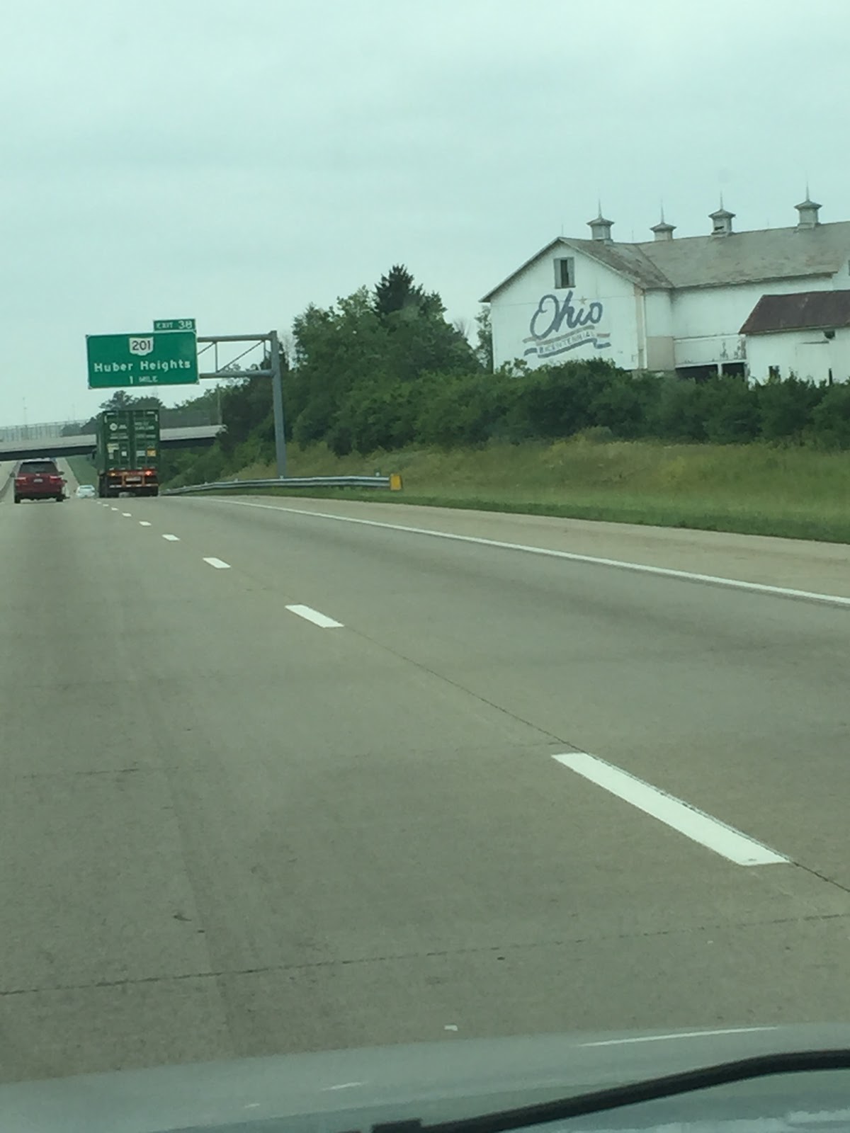
Driving through Ohio was fun. Lots of interesting things to see.

Welcome to Indiana, somewhere on US 35. There's nothing around!

A thumbs up to being almost at our destination of Muncie, IN!

Sunday, April 12, 2015

Severe Weather Outlook - 4/12/15

A surface cold front that will be moving through the Northern Plains and Upper Missouri Valley into the Northern Great Lakes could stir up some severe weather today in the Central Plains states.


Some strong to severe thunderstorms will become possible as the day progresses into the late afternoon and evening hours around the slight area in the Mid-Missouri Valley and into the southern plains. Main weather risks associated with these afternoon storms will be large hail and damaging winds.

Later this afternoon and evening the eastward progression of a mid-to-upper level low over Northern Mexico will help facilitate thunderstorm development around the slight risk area in Texas. Cloud cover in the area currently is hindering surface heating, but moderate buoyancy will help some storms fire up with the risk factors being some outflow gusts and damaging winds.

As always keep your eye to the sky and be weather savvy!

Wednesday, April 8, 2015

Severe Weather Risk in Central US


Looks like today and tomorrow can produce some severe weather for parts of the United States. Severe storms are expected to develop over parts of the southern/central plain states to the Missouri Ozarks in the afternoon and evening hours.

Using the map above, made by StormTrackerWx lead meteorologist Jason Berry, It can be seen that possible tornado development in the marked areas are as follows:

Red or Moderate areas: 60%
Orange or Enhanced areas: 40%
Yellow or Slight areas: 20% or less

Wind and hail probabilities are summarized in the above map as well.

Locations expected to see the most severe storms are:

  • Southeast Kansas
  • Missouri
  • Northern Oklahoma
  • Western Illinois


These storms can bring large hail and damaging winds along with the development of several tornadoes. Other areas such as parts of Texas and northeastward into the Ohio Valley and Central Appalachians have the possibility to see strong to severe storms.

If you live in these areas please just keep a close eye on the weather and be ready to take action. Know your weather safety!

Check back tomorrow for another post summarizing tomorrow's severe weather outlook.

Thursday, March 26, 2015

Severe Weather Season in Plains Gaining Momentum

As we all know, severe weather season is approaching quickly for the Great Plains and it seems the season most weather enthusiasts dream of is finally starting to gain some momentum. This year 'tornado season' has been eerily quiet. Up until yesterday, the Great Plains states has not seen a single tornado touch down since January 4th of this year, where an EF2 touched down just north of Dozier, Alabama.

Meteorological conditions have to be just right in order to fuel thunderstorm development, and this year we just haven't seen those perfect conditions. Yesterday's weather pattern in the plains provided conditions that were just right - which produced a few tornadoes. As a low moved across the mid-west, a front was able to supply the lift needed to produce that rising motion in the atmosphere needed for storm development. From there a southerly flow from the Gulf provided enough moisture to fuel thunderstorms and finally, there was enough wind shear to create 'spin' in the atmosphere to help fuel tornado development. Sure enough by late afternoon the first tornado warning was issued near Tulsa, Oklahoma.

As the evening went on storms began to fire across Oklahoma, Alabama, and Missouri, with Oklahoma and Arkansas seeing the worst of it. While most of the storms were severe thunderstorm warned, only a few were tornado warned. According to the Storm Prediction Center, there were 7 tornado reports yesterday across Oklahoma and Arkansas. Unfortunately there was 1 fatality in a mobile home park located in Sand Springs, OK.

Storm reports for 3/25/2015 as seen on SPC Website.

The residents of Moore, OK saw yet another tornado rip through their town yesterday as well. The cell that produced this tornado actually took a while to be warned. A lot of meteorologist were buzzing on Twitter about this. It is thought that there was a tornado on the ground before the storm was warned. Hook-echo, low level rotation, and a debris ball were all evident on radar as the storm approached Moore, but the excitement of the storm moving through Oklahoma City at the time overshadowed the tornado touchdown near Moore. Just before the tornado moved through Moore, the cell was finally warned. This city seems to have some pretty bad luck with severe weather as they saw an F5 in 1999, an F4 in 2003, an EF4 in 2010, an EF5 in 2013, and the tornado that ravaged parts of the town last night. Many Twitter posts show damage to the unlucky town, including damage to the make shift emergency room that was set up after the city's hospital was destroyed by the 2013, EF5 monster.

Damage in Moore, Ok from yesterday's tornado touchdown.

Moore, OK funnel.

Past tornado paths through Moore, Ok. as posted on Twitter.


Tornado sirens were heard in Oklahoma City as an intense thunderstorm moved through the area. Thankfully there was no tornado touchdown with that particular storm, as it would have passed directly over the city causing major damage and putting many lives in danger. The view of the storm as it passed over the city was incredible though, unfortunately I cannot find any images to share.

So after all of yesterday's weather excitement, what is going on today?


There will be scattered thunderstorms spread over the areas in green on the map above, due to a cold front moving eastward and through these areas. All areas highlighted in green should keep a close watch as some severe storms can fire up in the afternoon hours. Some of these storms in the Mid-Atlantic and Gulf coast regions can be accompanied by some strong winds, which will occur mainly this afternoon.

As always just keep an eye to the sky and be weather-savvy!

Sunday, March 8, 2015

Spring Has Partially Sprung!

This winter has brought some brutally cold temperatures and a lot of snowfall this year, which is why many of us will be excited to know warmer temperatures are coming our way! Finally all the snow that has fallen over this season will have a chance to melt away due to a weather pattern change that is expected to stick around into next week. Woo-Hoo! (...Unless you like snow and cold temperatures.)

StormTrackerWx lead meteorologist, Jason Berry, prepared this temperature map to post on our Facebook page. The map
shows high temperatures for various cities across the United States yesterday. Many of these cities are seeing warm-ups in
temperatures, as many places have been seeing below average temperatures all winter season.
Spring begins on March 20th and it certainly does seem that spring is headed our way as many cities which have seen below average temperatures for most of this winter season are finally warming up to average or above average March temperatures.

This map from Intellicast shows today's temperature departure throughout the United States. Blue is below average, no color
is normal, and orange/yellow is above normal temperatures.
As seen in the map above, most places in the United States are seeing average or above average temperatures, with the exception of parts of the south-central United States. As March progresses temperatures should begin to warm up and stay in the normal range which means we can all embrace the beautiful spring weather that is soon approaching! I don't know about you, but here at StormTrackerWx.com, we are excited to see the flowers bloom and trees bud! Let's keep our fingers crossed as it seems this nice weather will stick around into next week!

Let me close with this picture of the beautiful sun...which we haven't seen much of since winter took over our weather for the season!

Picture taken in Wilkes-Barre, Pa by StormTrackerWx meteorologist, Ashley Ellis.

Tuesday, March 3, 2015

March Comes in Like a Lion...

The old saying "March comes in like a lion and out like a lamb" is looking to be true this year, so far as yet another winter storm moves through the Northeast today and the Central United States last night and early this morning. Most area schools started dismissing students early today in anticipation for the wintry mix, with most students being home by 12pm. (With a few exceptions of course). Snow started to fall around 1pm today, but that didn't last long. After a few hours and a dusting of snow here in Wilkes Barre, Pa. the sleet began to fall hard and wind picked up, making it brutal outside.

Currently, in the Wilkes Barre/Scranton area, sleet is still falling and the temperature is 24 degrees. Roads and sidewalks are covered and slick due to sleet and snow accumulations and the NWS has issued a special weather statement for the area. If driving isn't a must tonight, please stay inside as travel conditions can become very treacherous, due to this wintry mix.

Sleet and freezing rain will continue for most of the afternoon and evening hours, then become spotty around midnight. The Wilkes Barre are can expect 1-3 inches and a light coating of ice from this early March storm. There is a possibility for some minor tree damage and power outages due to ice accumulations. Temperatures should rise into the low 30s by Wednesday morning.

Current conditions in Wilkes Barre, Pa. A dusting of snow
is on the ground, covered with sleet accumulations. I almost
slipped on my porch taking this photo! Please be careful if you
must travel this evening and tonight.

Saturday, January 31, 2015

Here Comes Linus!


It looks like the Northeast (and a few other areas) are in for yet another winter storm!


After Juno dumped crippling amounts of snow on the Northeast and New England last week, the 6z GFS is forecasting yet another winter storm. Decent amounts of precipitation from Illinois through the Northeast/New England states will fall Sunday through Monday due to the newest named winter storm, Linus. Most of Indiana and Ohio are looking at liquid equivalents of about half an inch from 6pm -12am Sunday into Monday. Using those values and a 10:1 snow-water ratio (how many inches of snow will fall from 1 inch of rain), we can expect 5-6 inches of snow to fall in these areas. (Just using the 6-hr precip image to the left, snowfall totals will be more as snow accumulates over the length of the storm). As the low progresses eastward, it will strengthen, turn north and move up the coast. Here is where is bombs out (yet again) and drops more snow on the Northeast and New England states.

The above images show the positioning of the storm Sunday night. The low is centered over Virginia and the 540 line (the red dashed line thats going through the L in low, commonly called the rain snow line) suggests that the areas south of Pennsylvania will most likely see a mix of rain and snow during this time. Referring the the 6-hour precip image, it is suggested that at this time, Central and Northeast PA, New York, Massachusetts, Rhode Island, and Connecticut will see the heaviest snowfall and largest accumulations. Most of these areas can expect to see between 6-10" with some areas seeing up to 12-18". These areas would be the darkest blue areas on the map above. After discussing positioning of the storm with the StormTrackerWx lead meteorologist, we think that the 12-18" snowfall accumulations on the 72-hour snowfall forecast map could be shifted slightly south. This would mean that central Illinois, central Indiana and central Ohio could see greater snowfall totals than shown by this map. The agreement of both the NAM and the GFS with the positioning of the storm helped facilitated in making this decision.

72-hour snowfall totals due to winter storm Linus. This map shows more in depth expected snowfall amounts for the areas
that will be affected by the newest named winter storm. Photo courtesy of : The Weather Channel

Sunday, January 25, 2015

Winter Storm Juno Forecasted to Impact the Northeast and New England Sunday through Tuesday.

The sun peaks out in Wilkes-Barre today, but this is the
calm before the storm, as Juno makes its way into the area tonight
and Monday. Photo courtesy of: Ashley Ellis.

As I sit here writing this post, it is a beautiful day here in Wilkes-Barre, PA! That won't last long though, as winter storm Juno moves toward the Northeast and New England. It is expected to dump a foot or more of snow in some areas and bring blizzard like conditions to coastal areas in the Northeast and New England, Monday and Tuesday. Things have changed some since I sat down yesterday morning to write about this "clipper" system. Here are the newest updates and forecasts!

Juno will affect much of Iowa, Illinois, Indiana, Ohio, and western Pennsylvania Sunday into Sunday evening. Much of the forecast for these areas in the last post hasn't changed much. By Monday, though, things become interesting as the storm starts to move up the coast and begins to intensify. All of Pennsylvania, New York, Rhode Island, Connecticut, and Massachusetts will be seeing snowfall from Juno by then. On Tuesday, eastern Pennsylvania, most of New York, and all of the New England states will be feeling the impacts of Juno as it strengths and drops significant amounts of snow in the Northeast and New England.

As winter storm Juno moves up the coast it will bomb out (bombing out is a drop in pressure of 24mb or more in 24 hours, this signifies a very intense storm) and dump possibly up to 2 feet of snow (possibly more locally) in some coastal areas.

Updated storm totals are as follows:
  • Most of Pennsylvania will see between 5-8", with a few areas such as parts of central/western PA and Philadelphia receiving 8-12".
  • New York has a wide spread of snowfall anywhere between 5-24". The snowfall totals increase as you move east. Therefore, central NY should see anywhere between 5-8", while New York City will receive around 8-12". The most southeast portions of NY contain the areas that will see 18-24".
  • Connecticut, Rhode Island, and Massachusetts will see the greatest impacts from Juno, as all 3 states will see snowfall totals of at least 18-24" with some areas, such as around Boston, receiving 24"+.
  • Vermont, New Hampshire, and Maine will also see a large spread in snowfall amounts. 
    • Northern Vermont: 5-8"
    • Central Vermont: 8-12"
    • Southern Vermont: 18-24"
    • Northern New Hampshire: 12-18"
    • Southern New Hampshire: 18-24", with 24"+ in the most southeast tip of the state.
    • Northern Maine: 8-12"
    • Central Maine: 12-18"
    • Southern Maine: 18-24"
Snowfall total map showing snowfall totals for the affected areas,
along with a summary of snowfall totals for large cities.
Photo courtesy of Weather.com

Along with dropping massive amounts of snow in some areas (snowfall rates of 2" per hour in some places), near blizzard-like conditions can be expected in the coastal areas as the storm quickly intensifies. Please don't venture out on the roads during the storm if it isn't absolutely necessary. This storm will cause very hazardous driving conditions in most areas affected, especially with the amount of snowfall forecasted and the gusty winds that are expected. 


Saturday, January 24, 2015

Next Potential for Snow

After this last snow storm affected parts of the Northeast and New England, there is more potential for some extra snowfall in a few areas.

Low pressure system sitting over Illinois on Sunday can be
expected to bring some snow to surrounding areas.
Projected precip amounts ending Sunday night. 1 inch of liquid
is about equivalent to 10 inches of powder snow.
A low pressure system is currently developing in the Dakotas and will strengthen as it swoops southeast. The GFS suggests that Illinois, Indiana, Ohio, Kentucky, central Tennessee, West Virginia, Virginia, and parts of Pennsylvania can expect to see some more snow Sunday and Monday. This storm can be classified as a clipper and will move through the area fairly quickly.


NAM predicted snowfall amounts for the same time
period shown to the left by the GFS.
Snowfall amounts don't appear to be very significant at this point though Western Ohio, Eastern Indiana, Kentucky, and central Tennessee should see the most snowfall amounts with about 2-3 inches of snowfall predicted by the current GFS model, though locally higher amounts can be seen. The NAM seems to  be in close agreement with the GFS. Slight differences are seen in snowfall amounts and positioning of the precipitation. StormTrackerWx meteorologists will keep monitoring the development of this clipper system and will keep you updated as needed!

Monday, January 5, 2015

Winter Storm "Gorgon" - What to Expect

A disturbance in the jet stream will be what drives a weak clipper system, otherwise known as winter storm Gorgon, across the US Monday and Tuesday.

On Monday snow will be in the Rocky Mountain region, where snowfall totals in a few spot could exceed 2 feet. Windy conditions will reduce visibility and below zero wind chills could create very dangerous situations in some cases. As the storm progresses eastward it will lose some of it strength, reducing snowfall amounts and wind gusts.

By Monday night, the weakened clipper system will move into the Great Lakes regions and parts of the Ohio Valley, where snowfall totals will tapper off slightly. Snowfall totals in Illinois, Indiana, and Western/Central Ohio should be around 3-5 inches. By late Monday night the storm will reach West Virginia and Western Pennsylvania. In these regions due to the storm losing it's strength, the snowfall will be light with snowfall totals around 1-3 inches in most places.

Gorgon will move into the Northeast Tuesday, slightly affecting the morning commute for Philadelphia, Baltimore, and Washington D.C. where a dusting will be seen. As the day progresses most areas affected by the storm will see snowfall amounts of about 1-3 inches. North-central PA and South-central NY will see around an inch or less. By Tuesday night, Gorgon will move out to sea, but areas prone to Lake Effect Snow will see some additional snowfall after the clipper system moves off the coast.

Wednesday, December 24, 2014

Who Will Wake Up to a White Christmas This Year?

It's Christmas Eve and we are all wondering who will wake up to a white Christmas this year. It has been uncertain over the last few days what the weather patterns here in the US would bring to us for Christmas Day. Here in the northeast, we experienced a very soggy Christmas Eve. The rain lasted all day and was heavy at times, putting a slight damper on some last minute Christmas shopping plans. Despite all the rain, there were still a lot of shoppers out checking those final items off their Christmas shopping lists. Now that we are well into Christmas Eve and Christmas is only a few hours away a more accurate forecast can be made.

A Christmas Eve storm brought snow to the Pacific Northwest and the Northern Rockies today, and it will bring a white Christmas to some. This newest winter storm has been named Eris and tomorrow it will bring snow to Utah, Wyoming, southeast Idaho and western Colorado. Residents in these mid-western states will have a white Christmas this year, but along with a white Christmas comes tricky travel conditions. If you are traveling on the following interstates on Christmas Day, please take your time and be safe:

Interstate 15: Butte, Montana into Utah
Interstate 25: Southern Montana into Wyoming
Interstate 70: Colorado high country into Utah
Interstate 80: Nebraska panhandle into Utah

Have you heard that Hawaii can get blizzards on Christmas Eve too? This Christmas Eve brought blizzard like conditions to Mauna Kea and Mauna Loa. The last time a blizzard warning was issued for Hawaii was in 2007, making this only the second blizzard warning issued for Hawaii since 1986. Even though these conditions didn't affect populated areas of the Big Island, it is pretty interesting to hear that some unexpected areas can have a white Christmas too!

From our family here at StormTrackerWx to yours, Happy Holidays and have a happy and safe New Year!

Sunday, November 9, 2014

Post Nuri: U.S. Braces for Arctic Invasion in Wake of Record-Breaking Storm

As of this morning Ex-Typhoon Nuri, located in the Bearing Sea, bombed-out to 924 mb. This makes it the strongest extratropical cyclone in the Pacific Ocean, breaking the previous record of 925mb that occurred between October 25-26 of 1977.

For those of you following this story, you hear a lot of Meteorologists using the term "bombing-out", but what does this term mean?  Simply put, "bombing-out" refers to a Low that drops 24mb or more in pressure over a 24 hour period.

It's not often we hear about how storms in the Pacific Ocean affect our weather 4,500 miles away.  However, a storm of this magnitude and strength will ultimately lead to a cold snap that will affect 42 or more states across the contiguous U.S. by week's end.

Extratropical storm Nuri, The lines are streamlines that represent
 how fast the winds around the storm are moving. The more
streamlines in any given area, the faster the wind.
Photo Courtesy of :Earth wind map
After battering Alaska with hurricane-force winds, 50-foot swells, and coastal erosion, Nuri will interfere with the jet stream (the level of high winds between 250mb and 300mb, or 9000m above mean sea level). The jet stream helps push air masses associated with High and Low pressure around the globe, which greatly affect everyday weather patterns.

Nuri is expected to cause a very large ridge of High pressure across the Eastern Pacific, parts of Central/ Eastern Canada, and the United States. As this ridge amplifies, a trough of Low pressure will deepen across the Central and Eastern U.S. This is what Meteorologists refer to as a teleconnection, or climate anomalies that are related across large distances. In this case, the trough associated with Nuri will bring arctic air from Canada into the U.S. by mid-week. 

As a result, heavy snow and strong winds will be felt in South Dakota, Minnesota, Northern Wisconsin, and Michigan's Upper-Peninsula, where Winter Storm Watches and Warnings are in effect.  Elsewhere, very cold temperatures will follow in the wake of a cold front, with highs struggling to warm above 32 degrees forecasted across parts of the Midwest, Mid-Atlantic, and Eastern Seaboard through the weekend


Tuesday, October 7, 2014

PSUDROPS Community Outreach Program Successful!

This past Saturday I volunteered my time to do some outreach in the State College community. This consisted of helping to educate the public on weather radar and instruments such, like the DOW (Doppler on Wheels) and the tornado pod. Instruments like this need to be talked about more. Without these we would not be able to see how severe storms develop, work, and how they move. They are extremely important to the Meteorology community. These are the instruments that gather weather data that help save lives!

The operator's Chair.

Dr. Richardson (Mesoscale Meteorology Professor)
in the Coordinator's Chair.

Myself and the Tornado Pod.


From 10am-3pm, I explained to members of the community the importance of such instruments in the Meteorological community. It was very exciting to see many parents encouraging their young children to learn more about the science behind weather. The day was very busy and we had 150-200 people come through, visit the DOW, and learn about the tornado pod. To see the excitement on the faces of the children who stopped by was truly inspiring.


Dr. Kumjian being interview by Jill (Meteo student)
 for a quick feature that she is working on for the Meteo dept.
I have one especially memorable moment from the event that I would like to share. I met this little boy who couldn't be more than 5 or 6 years old. His mother approached me and told me that he was afraid of thunderstorms and always looked at radar as storms were approaching to make sure that he was safe. This reminds me of my younger self; I was the exact same way. This is the exact way I became interested in the weather and then went on to pursue a Meterology degree at Penn State. To share this personal experience with this child was such a feel good experience. I was able to explain to him how thunderstorms worked and told him how interesting and cool they really were. I felt so satisfied having this experience and being able to relate on a personal level. Maybe one day in the child's future he will remember the conversation we had and he will go on to do great things in the Meteorology community!

All-in-all the day was very successful and I felt that the Meteorology department here at Penn State received a lot positive publicity. It was a lot of fun to be able to teach young and old about the cool things we do here in the department, and about how cool this science really is. I was interviewed quickly by a classmate on how I felt about the DOW visit and that was exciting as well! This has been a fantastic week so far!

Members of the community gathering around the tornado pod
learning about it uses.

Meteorology students (including myself) posing with the tornado pod.

Friday, October 3, 2014

First Deployment in the DOW

A quick update on the DOW visit! Today was my our day to deploy (Helen, Emily, Johan, and I) and we couldn't have better timing for our deployment. Our shift was from 5-7pm, we left around 430pm and made it to the site at 445pm. After the group before us finished up their scans, we took a few pictures with the DOW and jumped in to begin our adventure. Shortly after getting in the DOW, discussing our strategies and getting used to the controls, the front started to approach us.


When you first climb up the door to get into the DOW in can be very overwhelming. There are 2 main sets of computers, one is for the operator and the other is for the coordinator. Each person has their own set of duties while running radar sweeps. The operator is obviously the commander-in-chief. They are the person to run the scans. This includes switching pulses (which has to be done in a very specific order), choosing elevation angles to tell the radar to sweep over, changing the azimuth angles of the radar, controlling the speed at which the radar turns, controlling the highest and lowest elevation angles the radar will sweep at, and the list goes on and on. One can just imagine what this person's job would consist of. It is very overwhelming at times, especially when this is the first time you've done something like this. There are so many controls and buttons to play with! The coordinator can basically help with most of the above and are responsible for note-taking, which is super important so one can remember all the different things they did for their different scanning strategies. Things get a bit crazy inside the DOW, especially when you have a bunch of overzealous Meteorology students who are super excited about this project. For all of us this is the first time we've gotten hands on experience with radar, and for it to be the DOW, thats pretty big!


Me acting as the Operator of the DOW,
 running live radar sweeps.


The front moved through the area shortly after we started our shift. We started scanning only with PPIs, which are what you are used to seeing on a normal radar image. We did this because the front was still pretty far away, and there wasn't much to see in vertical cross-sections. As the storm moved closer we decided to add RHIs to our list of scans. After a little bit of editing and playing with the elevations angles and such, we finally were getting some interesting data. We saw Kelvin-Helmholtz instability/waves in the upper levels of the front. The bright band/ melting layer also made an appearance. This is the layer in the atmosphere in which the snow/ice begins melting and becomes coated in liquid water. At this layer, we see a jump in reflectivity, as water scatters the beam given off by the radar more than ice does.


Reflectivity and Velocity Image.
RHI scan showing vertical cross-section
of the front.

All in all we had such a fantastic experience on our first official DOW deployment and I was lucky to be paired with a group of enthusiastic people.  Dr. Kumjian stopped by to spend some time with us, and so did the new Meteorology department head, David Stensrud, and his wife. There is so much to take away from this experience and we here at Penn State are so lucky to have the opportunity to have hands on experience with the DOW for the next week. I am hoping to get out again sometime to scan maybe migrating birds, insects, or something else that can give us a cool signature. Even a wind farm would be fun, so we can see the velocity images and such. I want to leave you with a few more pictures from tonight of radar images and group photos! This photo above is with our deployment group, the Meteorology 434 (radar meteorology) professor and the DOW driver/operator, Traeger.


Picture of me standing in front of the DOW!!! Finally :)
                 
Example of the melting layer/bright band displayed in the vertical cross-section image of the storm.


The DOW 7.


Monday, September 29, 2014

DOW Visits PSU as Part of the PSUDROPS Program

Banner for the PSUDROPS program. Courtesy of PSUDROPS facebook event page.

This week at Penn State we are blessed to be visited by the DOW (Doppler on Wheels) as a part of the PSUDROPS (Penn State University Dual-pol Radar for Outreach and Precipitation Studies) program. As a meteorology student, I am required to learn how to operate, collect, and interpret data from the DOW in my Mesoscale and Radar meteorology courses as part of the expected course work. (Hence, the precipitation studies part of the acronym.) I figured this would be the perfect opportunity to construct a few interesting blog posts on the DOW.

"Tornado pod"
So far, I do know that I ( and a few other fellow students) might get the opportunity to take the DOW out on Friday night to scan the passage of a front. This will be used in our field project for Meteo434 (radar meteorology course). I have also volunteered to talk about the "tornado pod" on Saturday as part of an community outreach program during the State College Fall Festival. This is super exciting, as I have never seen a deployment pod in person before. I will try to document as much as I can and post blogs updates as they become available.

To be presented with this once in a lifetime opportunity to work with the DOW and to become acquainted with the procedures needed to run the radar and collect/interpret data is exciting. I am even more excited to share my experiences with you as they become available!

If you are interested in reading more, here is the facebook event page.


Enjoy a few photos that I took today during my quick crash course in DOW operations.


Close-up of "tornado pod"

Tornado pod with DOW7 in the background.